Display 4 of 20
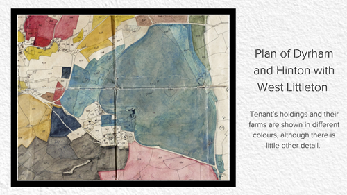
Plan of Dyrham and Hinton with West Littleton (D1799/P2)
This blue section in this image shows the extent of the parkland at Dyrham and is taken from an 1844 estate map drawn for the estate. The area was surveyed by Thomas Weaver of Bath and the full map shows the whole of the parishes of Dyrham and Hinton and West Littleton. Tenant’s holdings and their farms are shown in different colours, although there is little other detail. Dyrham House estate was a relatively small estate – about 4,500 acres or 7 square miles. The Badminton estate is around 52,000-acres – nearer 81 square miles!
Last reviewed: