
The works
Why the Works Were Needed
Detailed slope inspections and a Slope Stability Assessment identified several areas requiring intervention, including:
- Multiple rockfall hazard zones containing loose and unstable rock.
- Rock faces affected by weathering, undercutting and vegetation growth.
- Areas where material could fall onto the carriageway.
- Embankment instability and evidence of ongoing ground movement.
The works were required to reduce immediate safety risks and gather information needed to develop future long-term solutions.
What Works Were Undertaken?
Rockfall Protection Works
Specialist teams carried out:
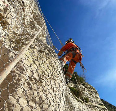
- Rock scaling and removal of loose or unstable material.
- Stabilisation works to identified hazard zones.
- Installation of rockfall protection netting.
- Additional stabilisation measures where previously unidentified instability was discovered.
Approximately 350 metres of slope were assessed and treated as part of the programme.
Ground Investigation Works
Five ground investigation locations were completed along the A466 corridor to improve understanding of the underlying ground conditions affecting the route.
The investigations included:
- Boreholes
- Trial pits
- Soil sampling
- Rock sampling
The information gathered has provided valuable data on subsurface conditions, slope behaviour and areas of instability. This information will be used to support the development and design of future major remediation and slope stabilisation works along the A466 Wye Valley route. The investigations also helped identify previously unknown areas of instability, contributing to a better understanding of the long-term risks associated with rockfall and ground movement.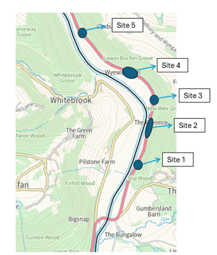
Slope Monitoring
Monitoring equipment was installed at key locations to:
- Track slope movement.
- Improve understanding of ground conditions.
- Support future asset management decisions.
- Provide data for development of long-term solutions.
Last reviewed: